Haute Route Trail Conditions July 2025
06/07/2025
Between guided TMB's Vic Chelton has been out on the Walkers Haute Route to check out trail conditions in the key areas. Here is what she has to say...
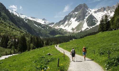
It’s now July 2025 and Summer Trekking on the WHR is Commencing.
Thankfully after a warm, dry spring and the recent heatwave, most of any lingering winter snow has melted, 90 percent of this section of trail is snow free.
Some Patches do still remain yet are Passable with extra caution in places.
Micro spikes are not essential yet useful if uncomfortable passing over small patches of snow patches/ slopes. Walking poles are highly recommended.
Trient to Champex Lac via the Fenetre d'Arpette: The route is snow free on both sides of the col, normal summer conditions.
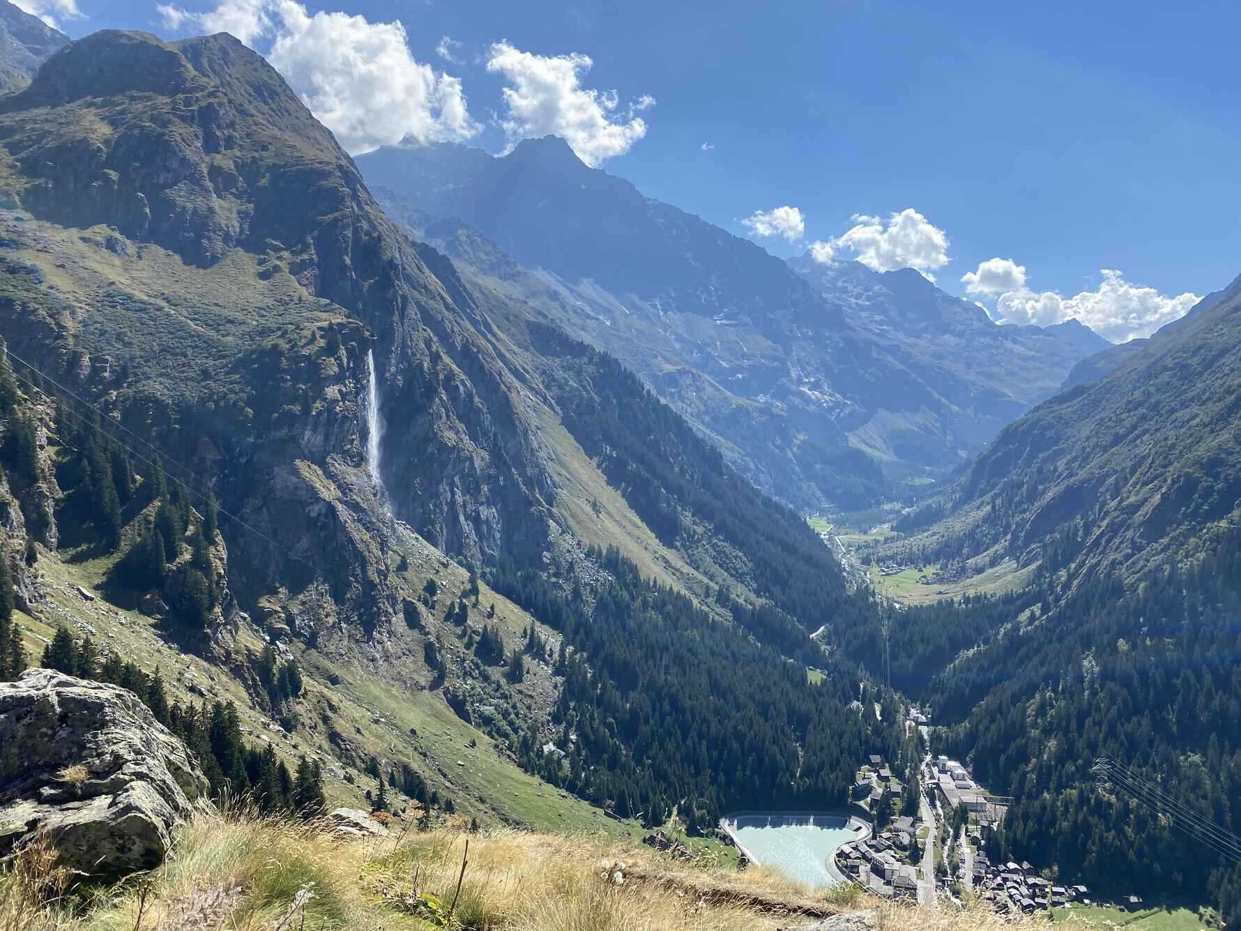
Champex Lac to Cabane Louvie via Fionnay: No complications or snow are present on the trail from Fionnay to the Cabane de Louvie. It’s also Important to note the Cabane de Louvie serve Dinner at 6.30pm, therefore essential to plan the day to arrive in adequate time.
Bus times can be found on the Swiss transport website: https://www.sbb.ch/en
Many Teams are arriving from the Verbier cable car / Mont Fort refuge via the Sentier des Chamois without any problems. Yet care is always needed on this section as the trail is steep and exposed.
Cababe Louvie to Cabane Prafleuri:
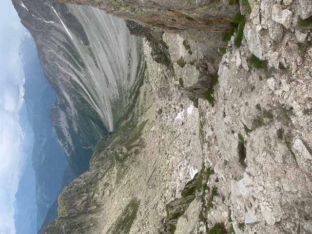
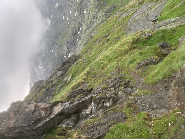
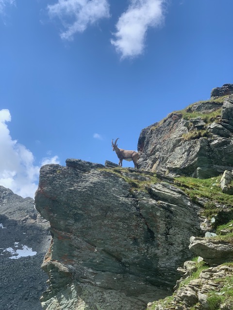
From the Cabane de Louvie to the Col de Louvie 2921m... there is only a few very tiny patches of snow that cause no problems. This section of trail always demands concentration as it is narrow and exposed. Chains are in place for security when needed. It’s a wild wonderful section of trail with so many Chamois, Ibex, marmots and flowers to be seen if you make an early start. It needs extra care in the wet and the route is never recommended in bad weather.
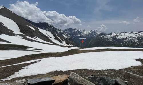
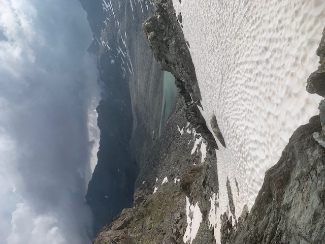
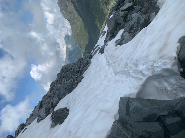
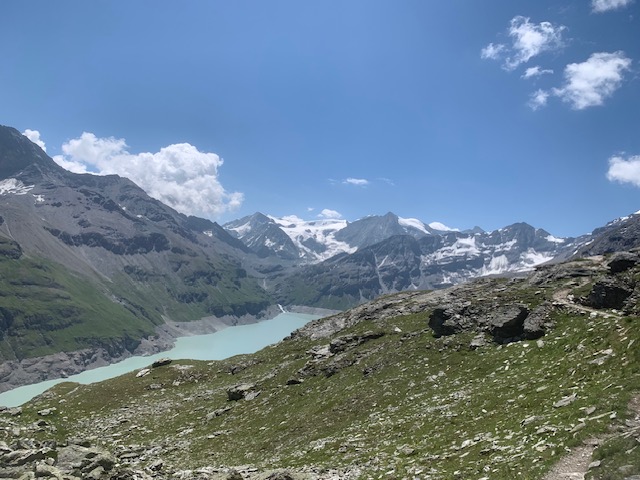
On arrival to the Col de Louvie 2921m the descent must be made to reach the small glacial lake of the Grand Desert 2760m. There are still some large patches of snow remaining on this section. The snow is soft and forgiving if not refrozen overnight. Watch out for holes!
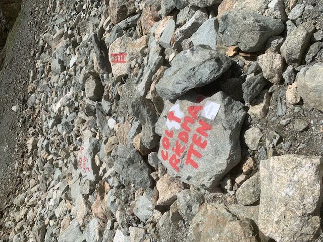
The first snow patch can be descended directly, there are tracks through the snow to follow and look out for painted markers to your left. There is a second patch of snow before arriving to the lake, which can be avoided on the left hand side.
The painted markers get a bit confusing before reaching the lake, Move leftwards following the markers until then moving right to pass the lake at its southern end. Keep looking for the markers along the way.
There a few stream beds to cross that may involve getting wet feet unless to take the time to remove socks/ shoes.
After here keep following the painted markers in the direction of Col de Plafleuri.
Attention !!!!
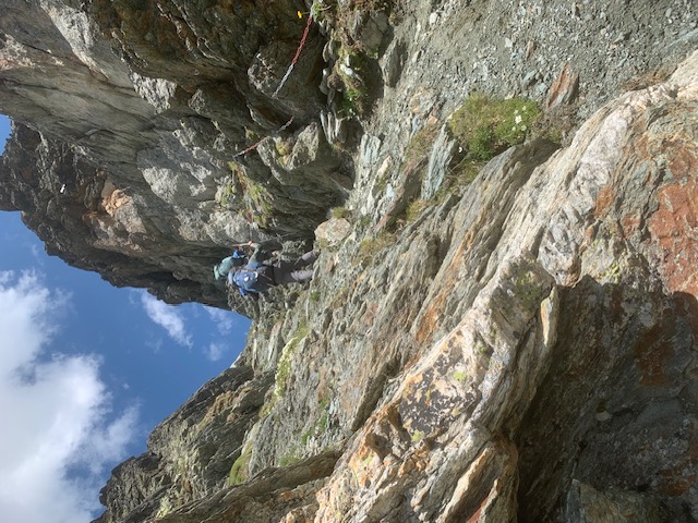
At around 2900m just before the twin lakes the trail makes a steep short descent through a rock band. This is a short but slightly difficult section that needs care. The path is obvious but a small exposed section of snow needs to be traversed and descended. There is a track in the snow however concentration in addition to slow steady movement is needed to reach the two lakes. From here be careful not to lose the painted markers and continue on to reach the Col de Plaflueri. The descent to Cabane de Plaflueri has no snow and is obvious to follow. Cabane de Plaflueri is looking cosy and well kept.
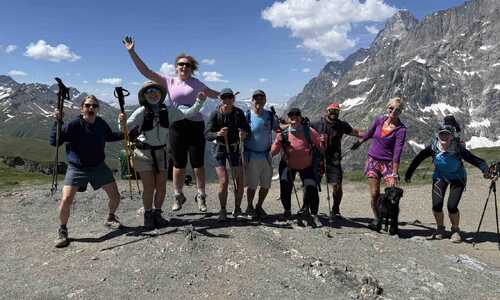
Cabane de Plaflueri to Arolla: Poses no problems, many teams out hiking and loads of Ibex looking as cool as ever!
Arolla to St Niklaus: No problems on the rest of the route, however it is advised that you have the Swiss Topo app on your mobile phone. This gives up to date information on any sections of the trail that are closed due to scheduled maintenance or landslide.
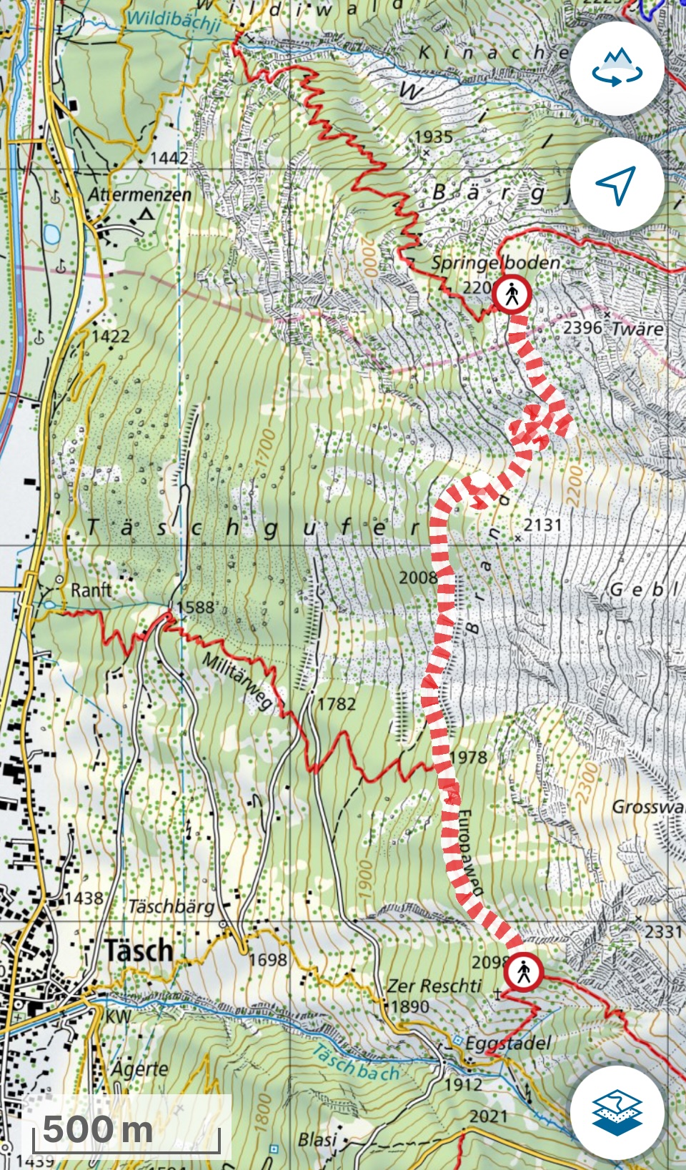
St Niklaus to Randa/ Tasch: As in previous years the valley route needs to be taken due the permanent closure of the Europaweg.
Randa/ Tasch to Zermatt: As in summer 2024 the section of the trail above Randa and Tasch is still closed due to rockfall, please follow diversions. The closed section is marked on the Swisstopo phone application, see below. Plan your route accordingly to avoid lots of additional ascend and descent.
If staying at the Europahutte you will need to follow the diversions in place.
If staying in Randa, Tasch, or travelling from St Niklaus then it might be worth missing the suspension bridge and ascending beyond the closed section.
Keep an eye on the Swiss Topo application as the trail might reopen during the season.
No further updates will be posted regarding the Walkers Haute Route trail conditions, unless there is something new to report once our first guided group has passed through from Chamonix to Zermatt.
About the Author